PRESIDENCY NETHERLANDS
2024-2025

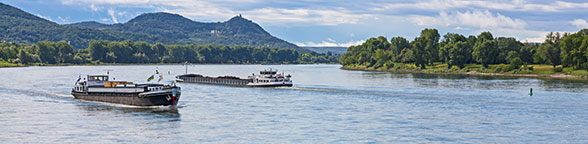
Information on the waterway Rhine
Introduction
The Rhine is one of the world’s most frequented inland waterways.
The following figures reflect the average number of vessels using the Rhine each day:
- 600 D/NL border
- 400 Cologne
- 300 Mainz
- 200 Karlsruhe
- 100 Iffezheim
The volumes transported amount to about 200 million tonnes at the German-Dutch border. With respect to traffic on the Dutch section of the river, the volume of goods transported on the Rhine can be estimated at 310 million tonnes.
The fleet travelling on the Rhine waterway can be estimated at about 6,900 vessels, representing a transport capacity of 10 million tonnes, of which 1,200 are pushed barges, 4,400 motor cargo vessels and 1,300 tankers.
Descriptions of the Rhine waterway may be found at the following sites:
- Wikipedia Rhine
- Encyclopédie BS éditions
- WSV.de Wasserstraße Rhein
- Expertise en InnovatieCentrum Binnenvaart

The bodies of the Central Commission responsible for the infrastructure
To respond to issues involving the Rhine as a waterway infrastructure, the Central Commission has established the Committee for infrastructure and environment (IEN) (until 2012: Permanent Technical Committee (TP)) and the specialised Working Group (IEN/G, until 2012: TP/G).
Activities of the Committee for infrastructure and environment (IEN):
- Monitor any works on the Rhine which might affect the navigation
- Investigate any navigation incidents with respect to how they might be related to the waterway infrastructure
- Monitor implementation for the Rhine of the Water Framework Directive and the Habitats Directives. Define the list of Natura 2000 zones affecting the Rhine waterway
- Cooperate with the ICPR (International Commission for the Protection of the Rhine)
- Collect information concerning the physical characteristics of the waterway Rhine:
- Bridge heights and vertical clearance
- Navigation channel profile - Monitor works carried out on locks
- Accommodate navigation on the to any possible effects of climate change Rhine
- Analyse interruptions of shipping and propose measures adopted to reduce them
- Determine equivalent water level
- Deal with cross-cutting issues related to the environment as well as basic questions concerning the sustainable development of inland navigation.
Committee Chairman: Mr. Ivo TEN BROEKE, Commissioner of The Netherlands
Secretariat: Mrs. STOCK
Working groups: IEN/G
Work programme 


Various information on the waterway Rhine
Up-to-date information on navigation conditions and water levels
Germany
Elwis.de: https://www.elwis.de/DE/dynamisch/gewaesserkunde/wasserstaende/
Pegel-online: https://www.pegelonline.wsv.de
Länderübergreifendes Hochwasserportal: https://www.hochwasserzentralen.de/
France
eRis: https://www.e-ris.eu/e-ris/
Vigicrues: https://www.vigicrues.gouv.fr/niv2-bassin.php?CdEntVigiCru=3
Netherlands
https://waterinfo.rws.nl
https://vaarweginformatie.nl
Switzerland
https://port-of-switzerland.ch/hafenservice/pegel/
Belgium
Flandern, Waterinfo: https://www.waterinfo.be
Wallonien, InfoCrue:
http://voies-hydrauliques.wallonie.be/opencms/opencms/fr/hydro/Actuelle/crue/index.html
Brüssel, Flowbru: https://www.flowbru.be
Characteristics of the waterway
Waterway profile of the Rhine
The profile of the waterway Rhine and in particular of the navigation channel is essentially determined by the relevant dimensions. The Secretariat of the CCNR has depicted the waterway profile in graphics that primarily serve to inform the interested public.
The binding maximum dimensions of vessels, pushed convoys and other vessel combinations are listed in Chapter 11 of the Police Regulations for the Navigation of the Rhine (RPNR).
Conditions of navigation channels
The desired profile of the navigation channel (width, depth) cannot always be met. Information about deviating widths and depths on the Rhine in Germany can be found here.
Available vertical clearance at bridges
The delegations report to the Committee the vertical clearances at bridges on the Rhine. This information is the subject of regular reports by the CCNR.
Vessel berthing area
The CCNR monitors the issue of available berthing areas for inland navigation vessels along the Rhine.
The Commission is authorised to set forth directives governing the desired number and quality of berthing areas in accordance with the development of shipping traffic.
A report is being prepared
Determination of equivalent water level
During that period, the discussions concerning the determination of water depth were carried out for a number of years in order to define the conditions for determining the water level.
The first average minimum water level was determined between 1839 and 1848 under CCNR auspices. During that period, the discussions concerning the determination of water depth were carried out for a number of years in order to define the conditions for determining the water level. In 1849, the Central Commission organised a first inspection voyage from Basel to the sea with the aim of determining the actual and the required water depth. This practice was institutionalised by the Mannheim Convention, which specifies in Article 31: “From time to time hydraulics engineers delegated by the Governments of all the riparian States shall conduct surveys to examine the state of the river, to observe the results of measures taken for its improvement and to note new obstacles which impede navigation. The Central Commission (art. 43) shall designate the time and the parts of the river where these surveys are to be made. The engineers shall report to it on the results”. Currently, the national authorities for waterway management are responsible for performing this inspection, and they present their report to the Committee for infrastructure and environment.
This concept was used as the basis for determining the equivalent water level, which was regularly measured and determined (1908, 1923, 1932, 1946, 1952, 1962, 1972, 1982, 1992, 2002, 2012 and 2022). The next determination of equivalent water level will be conducted under CCNR auspices starting in 2030.
The determination will be in accordance with the following principles:
- The equivalent flow values (GIQ) measured against the benchmark levels are recalculated every 10 years as flows within a 100-year time series
- The equivalent flow values are also used to recalculate the corresponding equivalent water level (EWL) values against the benchmark levels every 10 years;
- The equivalent water level (EWL) contains the following updated definition: “The equivalent water level (EWL) is the water level occurring along the Rhine at an equivalent low water flow falling below the long-term average for 20 days”.
The 2022 EWL comes into force with effect from 1 January 2023 and will remain in force until 31 December 2031. It is determined as follows:
| Level | EWL 2022 (cm)* |
|---|---|
| Basel | 501 |
| Maxau | 372 |
| Speyer | 237 |
| Mannheim | 155 |
| Worms | 68 |
| Mainz | 171 |
| Oestrich | 92 |
| Bingen | 97 |
| Kaub | 77 |
| Koblenz | 77 |
| Andernach | 91 |
| Bonn | 142 |
| Cologne | 139 |
| Düsseldorf | 91 |
| Ruhrort | 227 |
| Wesel | 174 |
| Rees | 118 |
| Emmerich | 74 |
| Lobith | 733 |
| Pannerdensche Kop | 700 |
| Nimwegen | 516 |
| Tiel | 255 |
| IJsselkop | 683 |
* Dutch values are cm + NAP (Normaal Amsterdams Peil)
Further information on the equivalent water level can be found in Resolution 2022-II-19 .
Works on the Rhine
The development and maintenance of the Rhine waterway fall under the competence of the riparian States. In certain cases these States have concluded specific international conventions or administrative agreements to this end.
The Central Commission for the Navigation of the Rhine plays the role of monitoring these measures within the international plan in order to supervise their coordination and to ensure their appropriateness to the needs of navigation.
Article 28 of the Revised Convention for Rhine Navigation stipulates that the contracting States will be active in maintaining the Rhine navigation channel and the towpaths. The States must, to the extent necessary, mark the channel by buoys. Each State bears the costs of maintaining the navigable channel along the section of the river concerning that State. Where the river serves as the border, each State shares half the costs.
Article 29 provides for the States to exchange information within the framework of the CCNR on hydraulic projects, the execution of which might have a direct or indirect influence on navigation. These provisions specify that the States must execute such schemes in the manner most acceptable to all parties and consult within the Central Commission on matters which might arise from the execution of such works.
Article 30 of the Mannheim Convention specifies for the Governments to take all necessary steps to ensure that navigation on the Rhine is not obstructed by any structures such as bridges or factories.
Article 31 stipulates that the national Governments will regularly examine the river to observe the results of measures taken for its improvement and to note any obstructions. A report is to be made to the Central Commission.
Specific agreements and regulations apply to canalisation works along the Upper Rhine.
Within the Central Commission, the Committee for infrastructure and environment (IEN) is responsible for matters related to the waterway infrastructure, in which it is assisted by its specialised Working Group (IEN/G). These bodies examine the communications by the delegations which are related to the measures taken to improve navigation conditions on the Rhine, and they are responsible for examining construction works which might have an effect on inland navigation in accordance with the procedures for laying down the conditions and requirements for structures along the Rhine within the Central Commission for the Navigation of the Rhine.
The Central Commission has agreed on minimum requirements and recommendations for the technical design of structures along the Rhine, which serve to evaluate construction measures and as criteria for decisions on approving structures along the Rhine.
Availability of the Rhine as transport infrastructure: monitoring interruptions in navigation
The Central Commission, which guarantees freedom of navigation on the Rhine, ensures optimum availability of the Rhine as a waterway in keeping with the principle of freedom of navigation.
A certain number of interruptions are inevitable. These are subject to close monitoring at the level of the CCNR.
- High water
Above a given level, river traffic is halted (Article 10.01 Rhine Police Regulation). - Low water
Unlike high water, there is no threshold beyond which navigation is prohibited. It is the responsibility of each vessel’s skipper to determine whether it is possible to travel within a given section of the waterway despite the reduced water level. - Interruption due to cultural events or other events (e.g.: "Rhine in Flames").
Such interruptions are generally brief and known a long time in advance.
Only few events of this type are recorded each year which involve a local interruption lasting from three to seven hours. Such occasional interruptions are known in advance, occurring no more than two or three times a year and interrupting navigation for three to twelve hours. - Interruptions due to police action
Such occasional interruptions are known in advance, occurring two or three times a year and interrupting navigation for three to twelve hours. - Interruptions due to an accident (e.g. interruptions due to the accidents involving the Excelsior and the Waldhof)
- Simultaneous closure of two locks
Such closures mainly concern the Upper Rhine.
The interruption may be due to an accidental event, a maintenance problem or strike action. From one to at most five closures of this type lasting from three to ten hours are recorded annually.
Exceptional interruptions occur at certain locks during the holiday season (Upper Rhine and Lek).
- Construction works on the waterway
Example: construction of new bridges
The CCNR is informed of such interruptions and monitors jointly with the competent national authorities the measures taken in order to limit the interruptions as far as possible.
The Commission also carries out a statistical evaluation of such interruptions. This results in an annual average of about a hundred hours, which shows that the Rhine offers exceptionally reliable conditions.
The Committee for infrastructure and environment is responsible for transparent procedures to notify the shipping industry of any interruptions in navigation.
Rhine ports
The Rhine has a large number of port infrastructures.
The Mannheim Convention includes various provisions applying to Rhine ports.
Articles 8 to 10 concern free ports, which are storage areas not subject to custom duties. These provisions have lost their applicability within the current context of free movement of goods.
(The Final Protocol of the Revised Convention for Rhine Navigation of 1868 specified the free ports existing at the time (Strasbourg, Kehl, Maxau, Leopoldshafen, Mannheim, Neuburg, Spire, Ludwigshafen, Mainz, Biebrich, Oberlahnstein, Coblenz, Cologne, Neuss, Düsseldorf, Uerdingen, Duisburg, Ruhrort, Wesel, Emmerich, Amsterdam, Rotterdam and Dordrecht)).
Article 11 stipulates that each of the riparian States will designate for one territory the ports and unloading places where boatmasters have the right to discharge or to load a cargo. The boatmasters may not load or unload at other places without special permission or only under exceptional circumstances.
These provisions are basically intended for customs purposes. Yet they result in an obligation for the States to ensure that Rhine navigation takes place in a manner adapted to the loading and unloading places.
This obligation also results from Article 27 paragraph 1 of the Revised Convention for Rhine Navigation: "The Governments of the riparian States will ensure that in the free ports, as in all other ports of the Rhine, all necessary measures are taken to facilitate loading, unloading and warehousing of merchandise and that the premises and equipment allocated to them are maintained in good order."
The regulations at individual ports depend on national law. The conditions for accessing existing public infrastructures at ports must not discriminate according to nationality. The principle of freedom of navigation does not constitute an obstacle to charging port dues in exchange for the services rendered. Article 27 paragraphs 2 and 3 (concerning ports) of the Revised Convention for Rhine Navigation specifies: "To meet the necessary costs of maintenance and supervision, an appropriate fee may be levied. Should the revenue from this fee exceed the amount of expenditure in question, the rate of said fee shall be reduced. However, this fee may be collected only when use has been made of the premises and equipment mentioned above".
The European Federation of Inland Ports (EFIP) is an organisation recognised by the Central Commission.
Information on the NATURA 2000 protected areas situated on the Rhine
Information on the NATURA 2000 protected areas situated on the Rhine
In the meantime, efforts and thought continue to be devoted to this issue. A detailed report was adopted by the Central Commission in 2011.
Climate change and the Rhine as a navigable waterway
Interim information from the Committee
Between 2008 and 2011, the CCNR published three reports on climate change and Rhine navigation based on the 4th IPCC report. In 2011, the CCNR instructed its then Permanent Technical Committee (TP) to continue to monitor the issue of climate change intensively and to submit a revised version of the submitted report by 2020 at the latest. The Infrastructure and Environment Committee (IEN), as the successor to the TP, last reviewed the conclusions based on the 5th IPCC report in 2019, with the result that they are still valid. New scientific findings on the hydrological regime of the Rhine are not expected to be available until after the publication and regionalization of the 6th IPCC report in 2024.
In the meantime, the IEN Committee, in cooperation with the Economic Committee (ECO), has produced several editions of the reflection paper “Act Now!”, which deals with low water and possible adaptation options. The Committee's assessment report on the effects of climate change on the Rhine waterway goes beyond low water and is also intended to identify changes in medium and high water discharge, analyze the effects and identify adaptation options. (See also Workshop “Low water and effects on Rhine navigation”)
In 2023, the CCNR began preparations to update the assessment report on climate change and its impact on infrastructure. It became apparent that the regionalization of the results based on the 6th IPCC report will not be available in 2024, but in 2026 at the earliest. As initial results show that there are relevant differences between the regionalized results of the 5th and 6th IPCC reports, it makes sense to base the work on updating the IEN Committee's assessment report on these new results, even if this means postponing the work by a further two years.
The following work by other organizations is relevant for updating the Committee's assessment report:
In its report on “Climate change induced discharge scenarios for the Rhine basin” based on the 5th IPCC report, the ICPR expert group HCLIM came to the conclusion that the earlier statements on changes in Rhine runoff are basically confirmed, but with a wider range and that many projections show that existing management practices may reach their limits in the future. The ICPR expert group HCLIM therefore recommends a review of the ICPR climate change adaptation strategy.
The CHR is expected to publish its “RheinBlick2027” report with the results of the regionalization of the 6th IPCC report in 2027. Initial results could possibly be made available to the IEN Committee as early as 2026.
Initial preliminary projections by Deltares based on the Dutch KNMI'23 scenarios based on the 6th IPCC report show an increase in maximum annual runoff of 5 to 25 % by 2100 for all moderate and high emission scenarios at the gauge station of Kaub. The low flow over a period of seven days (NM7Q, an indicator of droughts) will be lower in all wet and dry scenarios. The decrease varies between 10 and 30 % for the year 2100.
Based on these considerations, the committee has therefore decided to postpone the update of the assessment report and publish interim information instead. The IEN Committee's assessment report is expected to be completed in 2027. Conclusions on the possible adaptation of the waterway infrastructure cannot be drawn from this yet. To this end, the further CHR studies as part of the “RheinBlick2027” project must first be completed.
For more information, see also the interim information document on the effects of climate change on the Rhine waterway  .
.